The Real San Francisco: Eight Neighborhoods to Start With (and Why They're Nothing Alike)
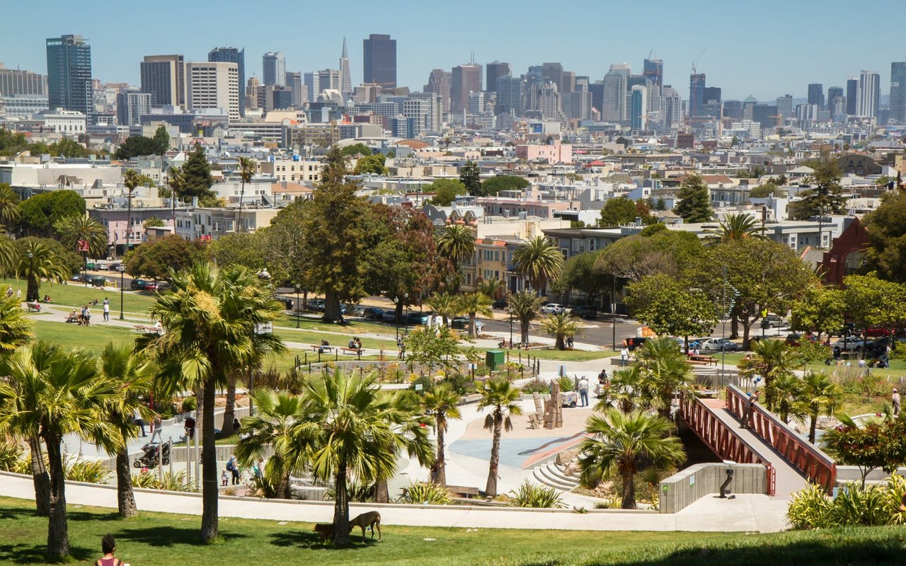
San Francisco's Planning Department officially recognizes 37 neighborhoods for planning and notification purposes, and locals will tell you the real number, once you count every informal pocket and sub-district residents actually use, runs well past that. That is too many neighborhoods to cover honestly in a single guide. So I am starting here, with eight neighborhoods that show the real range of what this city offers: Pacific Heights, Noe Valley, the Mission, Bernal Heights, SoMa, the Sunset, Mission Bay, and the Marina. Grand and understated, historic and brand new, foggy and sunlit, walkable and waterfront. If your neighborhood is not on this list, that does not mean I do not know it. It means there was not room for all 37, and these eight are where I wanted to start.
Anote before you read further: this guide leans heavily on history, architecture, and neighborhood character, the kind of texture that does not come from a spreadsheet. Every specific claim below is sourced, and sources are listed at the end. Market pricing figures move month to month and should always be verified against current MLS data before you rely on them for a purchase decision.
Pacific Heights
History and Character
Pacific Heights was first developed in the 1870s, when wealthy San Franciscans began building homes along the ridge running between Van Ness Avenue and the Presidio, deliberately positioning themselves above the fog and above Nob Hill's earlier elite. The neighborhood's position on solid bedrock, rather than the filled land found elsewhere in the city, meant it survived the 1906 earthquake and fire with far less damage than most of San Francisco, which is the physical reason the neighborhood's collection of pre-1920s mansions still stands today.
That survival gave Pacific Heights the densest concentration of intact Victorian, Edwardian, Queen Anne, and Beaux-Arts architecture in the city. The Spreckels Mansion on Washington Street, a French Baroque-style chateau built for sugar magnate Adolph B. Spreckels, and the Haas-Lilienthal House, a Queen Anne built from redwood timber and now a museum, are both still standing landmarks from that original era of development.
Homes and Architecture
The architectural vocabulary here is grand by design: Victorian, Edwardian, Queen Anne, and Beaux-Arts mansions dominate, many dating to the 1880s through the 1920s, with detailed woodwork, bay windows, and facades built to be seen from the street below. This is not a neighborhood of subtle homes.
Local Shops, Dining, and Daily Life
Fillmore Street is the neighborhood's commercial spine, a compact stretch of boutique retail and well-regarded restaurants within easy walking distance of nearly every residential block. Two parks, Alta Plaza and Lafayette Park, sit within the neighborhood and offer tennis courts, dog-friendly lawns, and some of the best skyline and bay views in the city.
The Vibe
Quiet, residential, and unmistakably upscale. This is a neighborhood built around private homes and ridge-top views rather than street-level bustle, though Fillmore Street brings a genuine, walkable commercial pulse to its edge.
Market Reality
Based on Redfin's tracked sales data, Pacific Heights' median sale price across all home types was running around $2.4 million as of May 2026, up sharply, roughly 25 percent, year over year.
This figure reflects a single month's mix of home types and price tiers, which can shift the reported median meaningfully. Verify current pricing against live MLS data before making a decision.
Schools: San Francisco Unified School District serves this neighborhood, which, unlike Peninsula districts, uses a citywide lottery-based enrollment system rather than guaranteed neighborhood schools. Address does not guarantee school assignment here the way it does south of the city; confirm current enrollment policy directly with SFUSD.
Transit: Served by several Muni bus lines along Fillmore, California, and Sacramento Streets, with no direct rail line running through the neighborhood's core.
Parking: Primarily street parking with resident permit zones in most areas; larger historic homes sometimes include garage parking, though it is not universal given the neighborhood's pre-automobile-era construction.
Best For: Buyers seeking San Francisco's most historically significant residential addresses, multi-generational estate purchases, and proximity to the Presidio.
Noe Valley
History and Character
Noe Valley takes its name from José de Jesús Noé, the last Mexican Alcalde of Yerba Buena before the city was renamed San Francisco. The neighborhood was primarily developed at the end of the 19th century and in the years immediately following the 1906 earthquake, which is why it contains such a strong concentration of classic Victorian and Edwardian residential architecture.
For most of the 20th century, Noe Valley was a working-class, blue-collar neighborhood. Its transformation accelerated after the 1989 Loma Prieta earthquake, when the collapse of the Central Freeway pushed tech commuters to discover that Noe Valley offered a shorter path to South Bay jobs alongside some of the city's warmest, sunniest streets.
Homes and Architecture
Noe Valley is defined by rows of well-preserved Victorian and Edwardian homes, many with classic bay windows and colorful facades, on a fixed housing stock with almost no room for new construction. That scarcity is part of what has kept the neighborhood's home values so resilient.
Local Shops, Dining, and Daily Life
24th Street is Noe Valley's commercial and social spine, and it has remained a genuinely independent corridor: locally owned coffee shops, bakeries, restaurants, and bookstores that serve the neighborhood rather than outside foot traffic. Church Street offers a smaller, secondary shopping strip. The neighborhood has earned the nickname "Stroller Valley" for its concentration of young families.
The Vibe
Warm, walkable, and genuinely community-oriented, closer to a small town than a big-city neighborhood. Neighbors know each other, a weekly farmers market draws locals, and the pace on 24th Street rewards lingering rather than rushing through.
Market Reality
Noe Valley's median sale price across all home types has generally run in the $1.3 million to $1.4 million range through 2026 per Redfin's tracked data, though a separate 2026 district-level analysis focused specifically on single-family houses (not condos) reported a considerably higher figure, around $2.88 million, reflecting the premium on Noe Valley's detached homes specifically.
These two figures are not contradictory, they measure different things (all home types versus houses only), but the gap illustrates how much home type affects a neighborhood median. Verify current pricing by property type against live MLS data before relying on either figure.
Schools: Served by San Francisco Unified School District's lottery-based enrollment system. Families should not assume neighborhood proximity guarantees a specific school assignment; confirm current enrollment policy directly with SFUSD.
Transit: The J Church Muni Metro line runs directly through the neighborhood along Church Street, connecting Noe Valley to downtown San Francisco, supplemented by the 48 Muni bus line along 24th Street.
Parking: Primarily street parking with permit zones; driveways and garages are present on many single-family lots but not universal, particularly closer to the 24th Street commercial corridor.
Best For: Families who want a walkable, sunny, community-oriented neighborhood with strong local identity and easy Muni access to downtown.
The Mission District
History and Character
The Mission takes its name from Mission San Francisco de Asís, commonly called Mission Dolores, founded by Spanish missionaries on October 9, 1776. It is the oldest surviving structure in San Francisco and has been in continuous religious use since the late 18th century, making the Mission one of the oldest continuously inhabited parts of the city.
The neighborhood's modern cultural identity took shape through decades of Latin American immigration, particularly from Central America beginning in the 1980s, and through the Chicano art movement of the 1970s, which used murals as a tool for cultural expression and political activism. According to a 2015 city planning study, 56 percent of Mission residents identified as Latino and 42 percent were foreign-born.
Homes and Architecture
Housing stock in the Mission is architecturally varied, older multi-unit Victorian and Edwardian buildings, converted industrial and warehouse spaces, and newer condominium development, reflecting the neighborhood's layered history as an immigrant gateway and, more recently, a tech-adjacent rental and ownership market.
Local Shops, Dining, and Daily Life
The Mission has one of the most concentrated independent restaurant and bar scenes in San Francisco, alongside a genuinely dense collection of street murals: Balmy Alley and Clarion Alley are the two best-known concentrations, with murals dating back to the mid-1980s addressing themes from Central American political history to contemporary gentrification.
The Vibe
Energetic, artistic, and culturally rich, one of the most walkable and visually alive neighborhoods in the city, with a genuine sense of history embedded in nearly every block.
Market Reality
Based on Redfin's tracked data, the Mission District's median sale price across all home types was running around $1.3 million as of April 2026, up roughly 11 percent year over year.
Verify current pricing against live MLS data, as the Mission's housing stock mix (multi-unit buildings, converted lofts, and single-family homes) can shift a monthly median meaningfully.
Schools: Served by San Francisco Unified School District's lottery-based enrollment system; confirm current enrollment policy directly with SFUSD.
Transit: Served by BART (16th Street and 24th Street Mission stations) and multiple Muni bus lines, making it one of the best rail-connected neighborhoods in the city for South Bay and East Bay commuters alike.
Parking: Street parking is common but competitive, particularly near BART stations and the 16th and 24th Street commercial corridors; off-street parking is inconsistent depending on building age and type.
Best For: Buyers who want culture, walkability, direct BART access, and a neighborhood with deep, visible history.
Bernal Heights
History and Character
Bernal Heights was part of a Mexican land grant given to José Cornelio Bernal in 1839. The hill at its center is built on bedrock, largely seismic-dampening radiolarian chert, which meant many of its structures survived the 1906 earthquake intact. That resilience drew displaced San Franciscans to the neighborhood afterward, and some of the tiny "earthquake cottages" built to house refugees still stand in Bernal Heights today.
The neighborhood's commercial corridor, Cortland Avenue, has been Bernal's main street for more than a century. It fell into decline for much of the mid-20th century before a turning point in 1991, when a local grocery store chose Cortland for a second location, quickly followed by a destination restaurant. That combination is often credited with beginning Bernal's revival.
Homes and Architecture
A genuine mix of Victorian and Edwardian cottages, many dating to the earthquake-cottage era, alongside more contemporary renovations. Lots and homes tend to be smaller and more modest in scale than Pacific Heights or the Marina, in keeping with the neighborhood's working-class roots.
Local Shops, Dining, and Daily Life
Cortland Avenue carries the neighborhood's commercial life: independent boutiques, cafes, and restaurants including long-running institutions alongside newer additions. Bernal Heights Park sits atop the neighborhood's namesake hill and offers 360-degree views of the city and bay, a defining outdoor amenity within walking distance of most homes.
The Vibe
Small-town and tight-knit despite sitting entirely within San Francisco's city limits. Longtime residents describe it as working-class, progressive, and LGBTQ-friendly in character, with a hilltop, village-like feel that is distinct from the denser neighborhoods surrounding it.
Market Reality
Redfin's tracked data shows Bernal Heights' median sale price across all home types running between roughly $1.6 million and $1.7 million through the spring of 2026, depending on the exact month measured.
Verify current pricing against live MLS data, since Bernal Heights sees a modest sales volume relative to larger neighborhoods, which can make month-to-month medians move more than they would in a bigger market.
Schools: Served by San Francisco Unified School District's lottery-based enrollment system; confirm current enrollment policy directly with SFUSD.
Transit: Served by multiple Muni bus lines; the neighborhood does not have its own BART or Muni Metro rail station, though it sits within a reasonable distance of both the 24th Street Mission BART station and Muni lines running through the adjacent Mission District.
Parking: Primarily street parking on steep, narrow residential streets; driveways exist on some properties but are not universal given the neighborhood's hillside topography and earlier-era construction.
Best For: Buyers who want a genuine small-town, community feel, hilltop views, and a lower price point than Pacific Heights or the Marina while remaining fully within San Francisco.
SoMa (South of Market)
History and Character
SoMa's history runs almost directly opposite to Pacific Heights'. It began as a mixed low-density residential area in the mid-19th century, with Rincon Hill developing into a wealthy enclave and South Park into an upper-middle-class one, before heavy industrial development, docks, factories, and worker housing, pushed the wealthy out toward Nob Hill by the early 20th century. The 1906 earthquake and fire destroyed much of the area, and it was rebuilt with a deliberate focus on industry, with unusually wide streets designed for that purpose.
SoMa remained a working-class, industrial district for most of the 20th century until the 1990s dot-com boom, when technology companies were drawn to the neighborhood's cheap rents and large open warehouse floor plans. That transformation accelerated through the 2000s and 2010s as companies including Twitter, Airbnb, and Dropbox established headquarters in the area, cementing SoMa's reputation as a tech-industry hub even as much of that corporate presence has since shifted toward the neighboring South Beach district.
Homes and Architecture
SoMa's defining housing product is the converted warehouse loft: former industrial and manufacturing buildings turned into residential space with soaring ceilings, exposed structural elements, and oversized windows. Alongside these conversions sits a growing stock of new-construction condominium towers, meaning the neighborhood spans both industrial-chic lofts and modern high-rise living.
Local Shops, Dining, and Daily Life
SoMa is home to major cultural institutions including SFMOMA, the Yerba Buena Center for the Arts, and the Museum of the African Diaspora, alongside a genuinely diverse dining and nightlife scene. The neighborhood is also home to San Francisco's Leather and LGBTQ Cultural District, established in 2018 to recognize the area's long history as a center of queer life and culture.
The Vibe
Urban and energetic, closer to a downtown extension than a residential neighborhood in the traditional sense. SoMa mixes nightlife, tech offices, museums, and residential lofts in a way no other neighborhood on this list does.
Market Reality
Based on Redfin's tracked data, SoMa's median sale price was running around $830,000 as of the most recent reported month in 2026, up roughly 14.5 percent year over year.
This figure is meaningfully lower than most other neighborhoods on this list largely because SoMa's housing stock is dominated by condominiums rather than single-family homes, not because the neighborhood is broadly less expensive per square foot. Verify current pricing by unit type against live MLS data before making a decision.
Schools: Served by San Francisco Unified School District's lottery-based enrollment system. SoMa's household mix skews toward buyers without school-age children relative to more residential neighborhoods, though family-friendly pockets exist.
Transit: Among the best-connected neighborhoods in the city: served by BART, Muni Metro, and Caltrain's terminus at 4th and King, making it a strong option for buyers who commute south to the Peninsula or South Bay.
Parking: Predominantly building-based parking in condominium and loft developments rather than street parking, given the neighborhood's dense, urban character; street parking exists but is competitive.
Best For: Buyers who want downtown proximity, direct Caltrain access for Peninsula or South Bay commutes, and loft or high-rise condo living over a single-family home.
The Sunset District
History and Character
The Sunset was, until the early 20th century, mostly wind-swept sand dunes that maps once labeled the "Outside Lands." Development began in earnest after the 1906 earthquake, when small tract and row homes replaced a settlement called Carville, so named because its earliest residents lived in retired horsecars and cable cars parked in the dunes.
The neighborhood's defining building boom came in the 1930s, driven largely by developer Henry Doelger, who borrowed assembly-line construction methods to put up roughly two stucco houses a day on narrow 25-foot lots between 1934 and 1941, becoming the largest homebuilder in the country during that stretch. Historically an Irish and Italian enclave, the Sunset has seen a large Chinese immigrant population settle in the neighborhood since the late 1960s, and it remains one of the city's most significant Asian American communities today.
Homes and Architecture
Rows of pastel-colored, two-story stucco homes dominate the district, most built on identical 25-foot lots with a garage on the ground floor and living space above, a direct legacy of Doelger's assembly-line development model. Later builder Oliver Rousseau introduced more individualized homes into parts of the neighborhood, and some blocks feature storybook, Mediterranean, or French provincial period detailing distinct from the more uniform tract rows.
Local Shops, Dining, and Daily Life
The Inner Sunset's commercial corridor along 9th Avenue and Irving Street is genuinely lively, with a strong concentration of restaurants reflecting the neighborhood's large Asian American population. The district also provides direct access to Golden Gate Park, Ocean Beach, the San Francisco Zoo, and Lake Merced.
The Vibe
Quiet, foggy, and residential, with a noticeably slower pace than the Mission or SoMa. This is the district most defined by San Francisco's marine layer; expect meaningfully more fog and cooler temperatures here than in sunnier, more sheltered neighborhoods like Noe Valley or Bernal Heights.
Market Reality
Based on Redfin's tracked data, the Sunset District's median sale price across all home types was running around $1.9 million as of the three months ending June 2026, up nearly 19 percent year over year.
The Sunset is a large district covering several distinct sub-areas, Inner Sunset, Outer Sunset, Parkside, and Golden Gate Heights among them, and prices vary meaningfully by exact location within it. Verify current pricing for your specific target block against live MLS data.
Schools: Served by San Francisco Unified School District's lottery-based enrollment system; confirm current enrollment policy directly with SFUSD.
Transit: Served by the N Judah Muni Metro line and multiple bus lines running along the district's numbered avenues, connecting to downtown San Francisco.
Parking: Nearly every home in the district's classic tract rows includes a ground-floor garage, a defining feature of the neighborhood's original construction, making off-street parking meaningfully more available here than in most other San Francisco neighborhoods.
Best For: Buyers who want more space and value per dollar, a quieter, family-scaled residential feel, and don't mind trading sun and walkability for square footage and built-in parking.
Mission Bay
History and Character
Mission Bay is one of the few San Francisco neighborhoods built entirely from scratch. Once a tidal lagoon filled in by the Southern Pacific Railroad in the 1860s and later used as rail yards and industrial land, the 303-acre district began its transformation in 1998, when the San Francisco Board of Supervisors adopted a redevelopment plan, followed by groundbreaking on the UCSF Mission Bay research campus in 1999.
The neighborhood's identity solidified with the arrival of two anchor institutions: Oracle Park (home of the San Francisco Giants) to the north, and the 2019 opening of Chase Center, home to the Golden State Warriors, to the south. Because it was master-planned rather than organically developed, Mission Bay has wide sidewalks, connected bike lanes, and waterfront paths that most older San Francisco neighborhoods simply do not have room for.
Homes and Architecture
Almost entirely new-construction condominiums and apartments, built during and after the late-1990s redevelopment, a sharp contrast to the pre-1906 or pre-1940s housing stock found in most other neighborhoods on this list. There is essentially no historic housing inventory here.
Local Shops, Dining, and Daily Life
Fourth Street and the Thrive City complex surrounding Chase Center anchor the neighborhood's retail and dining, alongside newer waterfront parks including China Basin Park and Bayfront Park. The neighborhood also includes UCSF's biotech and research campus, Uber's global headquarters, and Visa's headquarters at the Mission Rock development.
The Vibe
New, active, and still filling in. Mission Bay has a polished, planned feel that is genuinely different from any other neighborhood in this guide, walkable and modern, with a level of energy tied closely to Warriors game nights and UCSF's daytime research population.
Market Reality
Based on Redfin's tracked data, Mission Bay's median sale price across all home types has been running between roughly $1.3 million and $1.5 million through 2026, with one reported month showing year-over-year growth as high as 77 percent.
That kind of swing reflects Mission Bay's still-limited and uneven sales volume as a newer neighborhood, not a stable trend. Verify current pricing against live MLS data before relying on any single figure.
Schools: Served by San Francisco Unified School District's lottery-based enrollment system. As a newer neighborhood, school infrastructure is still expanding alongside residential growth; confirm current options directly with SFUSD.
Transit: Served by the T Third Street Muni Metro line, with a dedicated Mission Bay shuttle connecting to the Transbay Terminal and Caltrain, making it a genuinely convenient option for South Bay commuters.
Parking: Predominantly building-based garage parking within new condominium developments, consistent with the neighborhood's modern, master-planned construction.
Best For: Buyers who want new construction, strong walkability, and direct rail access, and who don't need or want a historic building.
The Marina
History and Character
The Marina District did not exist as land until 1915. The area, then a tidal marsh known as Harbor View, was filled in with roughly 300,000 cubic yards of dirt and mud dredged from the bay, in some cases mixed with rubble from the 1906 earthquake, to create the site for the Panama-Pacific International Exposition, a world's fair celebrating both the opening of the Panama Canal and San Francisco's recovery from the earthquake and fire nine years earlier.
The fair ran for ten months in 1915 and drew more than 18 million visitors before nearly all of its grand, temporary exhibition halls were demolished. The Palace of Fine Arts, designed by architect Bernard Maybeck, is the sole surviving structure from the exposition and remains the neighborhood's defining landmark today. Because the Marina sits on filled land, it also experienced some of the city's most severe liquefaction damage during the 1989 Loma Prieta earthquake.
Homes and Architecture
A distinct "Marina style" of architecture emerged after the 1915 exposition, generally Mediterranean and Art Deco-influenced stucco buildings and flats developed through the 1920s and 1930s, alongside condominiums and multi-unit buildings closer to the waterfront.
Local Shops, Dining, and Daily Life
Chestnut Street and Union Street form the Marina's primary commercial corridors, dense with boutique retail, bars, and restaurants that draw both residents and visitors from across the city. The neighborhood's waterfront, including the Marina Green and the Palace of Fine Arts, offers some of the most walkable open space and skyline and Golden Gate Bridge views in San Francisco.
The Vibe
Social, polished, and active, one of the more youthful and outward-facing residential neighborhoods in the city, with a genuine emphasis on outdoor recreation along the waterfront.
Market Reality
Based on Redfin's tracked data, the Marina District's median sale price across all home types was running around $2.6 million as of April 2026, up roughly 11 percent year over year, though a separate data source in mid-2026 reported a lower figure closer to $1.9 million.
These figures diverge meaningfully depending on the source and the exact home-type mix measured in a given month. Given the Marina's blend of high-end single-family homes and more modestly priced condominiums, verify current pricing by property type against live MLS data before relying on any single number.
Schools: Served by San Francisco Unified School District's lottery-based enrollment system; confirm current enrollment policy directly with SFUSD.
Transit: Served by multiple Muni bus lines; the Marina does not have its own rail line, and residents commuting by train typically travel to a Muni Metro or BART connection elsewhere in the city.
Parking: Primarily street parking with resident permit zones, competitive given the neighborhood's density and popularity; some newer and larger buildings include garage parking.
Best For: Buyers who want a social, active, waterfront lifestyle with strong walkability to shops, restaurants, and open space, and who prioritize polish and views over historic character.
Side by Side: How These Eight Compare
A quick reference before you dig into any one neighborhood in depth.
Neighborhood | Character | Median Sale Price* | Best For |
|---|
Pacific Heights | Grand, historic, mansion-lined | ~$2.4M (all types) | Buyers seeking prestige, history, and space |
Noe Valley | Sunny, family-oriented, village feel | ~$1.3M–$1.4M (all types) | Families wanting a walkable, warm community |
The Mission | Vibrant, artistic, culturally rich | ~$1.3M (all types) | Buyers who want culture, food, and energy |
Bernal Heights | Small-town, hilltop, tight-knit | ~$1.6M–$1.7M (all types) | Buyers wanting community without the crowds |
SoMa | Urban, industrial-loft, condo-dense | ~$700K–$830K (mostly condos) | Buyers who want downtown proximity and loft living |
The Sunset | Foggy, quiet, coastal, family-scaled | ~$1.9M (all types) | Buyers who want space, quiet, and value per square foot |
Mission Bay | New, planned, waterfront, active | ~$1.3M–$1.5M (all types) | Buyers who want new construction and walkability |
Marina | Polished, social, bayfront | ~$2.6M (all types) | Buyers who want a social, active, view-driven lifestyle |
*Median sale prices reflect Redfin's most recently reported figures as of mid-2026 across all home types unless otherwise noted, and can shift meaningfully month to month depending on sales volume and the mix of homes that closed. Verify current pricing against live MLS data before making any decision.
How to Choose Between Them
A few honest starting points, based on what actually seems to drive the decision for buyers I talk with.
If history and architecture matter most: Pacific Heights, Noe Valley, and the Marina all offer genuine, well-preserved period architecture, though at very different price points and in very different settings.
If you want walkability and culture: The Mission and Noe Valley both offer strong, independently owned commercial corridors within walking distance of nearly every home.
If you want new construction over historic character: Mission Bay is the clear answer; it is the only neighborhood on this list built almost entirely after 1998.
If sun matters to your daily life: Noe Valley and Bernal Heights sit in some of the city's sunniest microclimates. The Sunset and, to a lesser extent, the Marina and SoMa see meaningfully more fog.
If you want built-in parking: The Sunset's classic tract homes almost universally include ground-floor garages, a genuine rarity in San Francisco.
If your commute runs south to the Peninsula or South Bay: SoMa and the Mission both offer direct Caltrain or BART access that most other neighborhoods on this list do not.
Frequently Asked Questions
How many neighborhoods does San Francisco actually have?
The San Francisco Planning Department officially recognizes 37 neighborhoods for zoning and public notification purposes. Other sources cite different figures, from 36 to more than 80, depending on whether informal sub-districts are counted. There is no single universally agreed-upon number, which is part of why this guide focuses on eight representative neighborhoods rather than attempting to cover all of them.
Why do school assignments work so differently here than on the Peninsula?
San Francisco Unified School District uses a lottery-based enrollment system rather than guaranteed neighborhood schools, which means living in a specific neighborhood does not guarantee your child attends the nearest school the way it typically does in Peninsula cities like Burlingame or San Mateo. This is one of the most common points of confusion for buyers moving into San Francisco from elsewhere in the Bay Area, and it is worth understanding clearly before you buy based on proximity to a specific school.
Which of these neighborhoods has the best value per square foot?
Based on the pricing data above, the Sunset District and SoMa generally offer the most space or the most accessible entry point per dollar, though for very different reasons: the Sunset because of its larger tract-home lots, and SoMa because its median is pulled down by a condo-heavy housing stock. Verify current listings against your specific budget and priorities.
Do any of these neighborhoods flood or carry other hazard risk I should know about?
The Marina District sits on filled land and experienced significant liquefaction damage during the 1989 Loma Prieta earthquake, which is worth understanding as part of your due diligence there. SoMa's flatter, low-lying areas also carry some flood risk according to recent hazard data. I'd encourage every buyer, regardless of neighborhood, to review current hazard disclosures for any specific property before making an offer.
Let's Find Your San Francisco Neighborhood
Eight neighborhoods is still a small slice of what San Francisco actually offers, and the right fit for you depends on specifics I can only work through in a real conversation: your budget, your commute, your priorities around schools, sun, space, and community. I have sold across the full Bay Area corridor for over 20 years and I am glad to walk you through the rest of the city's neighborhoods in detail.
Jacklyn O'Connor Friedland
Compass | Burlingame, CA
(650) 766 0791
jacklynfriedland.com
CA DRE# 01726418
This article is for informational purposes only. Market data reflects available MLS and Redfin information as of mid-2026 and is subject to change. Verify all figures with primary sources before relying on them. Contact a licensed real estate professional for current pricing and availability.
Sources and Citations
All sources used in this article are listed below. Statistics should be verified against primary sources before publication.
1. San Francisco Planning Department — Neighborhood Group Organizations. sfplanning.org/resource/neighborhood-group-organizations
2. Wikipedia — List of neighborhoods in San Francisco. en.wikipedia.org/wiki/List_of_neighborhoods_in_San_Francisco
3. Livabl — 14 historic photos that capture San Francisco's swanky Pacific Heights neighborhood. livabl.com/articles/news/14-historic-photos-sf-pacific-heights
4. Wikipedia — Chambers Mansion. en.wikipedia.org/wiki/Chambers_Mansion
5. Wikipedia — Noe Valley, San Francisco. en.wikipedia.org/wiki/Noe_Valley,_San_Francisco
6. Victorian Alliance San Francisco — Noe Valley History. victorianalliance.org/noe-valley-history/
7. SF Standard — Noe Valley Is a San Francisco Lesson in Making a Blue-Collar Neighborhood a Tech Favorite. sfstandard.com, May 28, 2026
8. Wikipedia — Church and 24th Street station. en.wikipedia.org/wiki/Church_and_24th_Street_station
9. San Francisco Travel — The Guide to San Francisco's Mission District Murals. sftravel.com/article/guide-to-san-franciscos-mission-district-murals
10. Medium (Celeste Orlosky) — Historical Character, Street Art, and Public Life in the Mission District of San Francisco. celesteom.medium.com
11. Wikipedia — Bernal Heights, San Francisco. en.wikipedia.org/wiki/Bernal_Heights,_San_Francisco
12. SFMOMA Public Knowledge — Bernal Heights. publicknowledge.sfmoma.org/take-part/bernal-heights/
13. Kiddle — Bernal Heights, San Francisco facts for kids. kids.kiddle.co/Bernal_Heights,_San_Francisco
14. The Frisc — What a Steep Bernal Heights Hillside Reveals About SF's State of Housing. thefrisc.com
15. Wikipedia — South of Market, San Francisco. en.wikipedia.org/wiki/South_of_Market,_San_Francisco
16. San Francisco Planning Department — Historic Context Statement, South of Market Area, June 30, 2009. sfplanning.s3.amazonaws.com
17. San Francisco Heritage — The Rise of Modern SOMA. sfheritage.org/heritage-in-the-neighborhoods/the-rise-of-modern-soma/
18. Wikipedia — Sunset District, San Francisco. en.wikipedia.org/wiki/Sunset_District,_San_Francisco
19. Western Neighborhoods Project — A Short History of the Sunset District. outsidelands.org/sunset.php
20. The Bold Italic — The Sunset District Was Built By An Aggressive YIMBY. thebolditalic.com, June 9, 2026
21. 7x7 Bay Area — The Sunset District's Architectural Renaissance. 7x7.com
22. Wikipedia — Mission Bay, San Francisco. en.wikipedia.org/wiki/Mission_Bay,_San_Francisco
23. Forbes — Why Mission Bay Is San Francisco's Next Great Neighborhood. forbes.com, December 6, 2025
24. Wikipedia — UCSF/Chase Center station. en.wikipedia.org/wiki/UCSF/Chase_Center_station
25. Museum of American Heritage — A Sense of Wonder: The 1915 San Francisco World's Fair. moah.org
26. KQED — Large Parts of the Bay Area Are Built on Fill. Why and Where? kqed.org/news/11799297
27. SFO Museum — Flying on Display: Aviation at the Panama-Pacific International Exposition. sfomuseum.org
28. Redfin — Pacific Heights, San Francisco Housing Market data. redfin.com/neighborhood/2074/CA/San-Francisco/Pacific-Heights/housing-market
29. Redfin — Bernal Heights, San Francisco Housing Market data. redfin.com/neighborhood/202/CA/San-Francisco/Bernal-Heights/housing-market
30. Redfin — Mission District, San Francisco Housing Market data. redfin.com/neighborhood/1352/CA/San-Francisco/Mission-District/housing-market
31. Redfin — SoMa, San Francisco Housing Market data. redfin.com/neighborhood/11212/CA/San-Francisco/SoMa/housing-market
32. Redfin — Sunset District, San Francisco Housing Market data. redfin.com/neighborhood/2657/CA/San-Francisco/Sunset-District/housing-market
33. Redfin — Mission Bay, San Francisco Housing Market data. redfin.com/neighborhood/1724/CA/San-Francisco/Mission-Bay/housing-market
34. Redfin — Marina District, San Francisco Housing Market data. redfin.com/neighborhood/1626/CA/San-Francisco/Marina-District/housing-market
35. Redfin — San Francisco Housing Market Overview, June 2026. redfin.com/city/17151/CA/San-Francisco/housing-market
36. Houzeo — Marina District, San Francisco Housing Market 2026. houzeo.com/housing-market/california/san-francisco/marina-district